Thursday, December 27, 2007

Wednesday, December 26, 2007
Iceland

Iceland is a country of extremes. it's amazing how people have come to live here. For instance, the was formed only because it lies on the boundary between two rifting tectonic plates. As a result, a large island in the middle of Atlantic Ocean with plenty of volcanic activity. But the people of Iceland learn to use this to their advantage. In fact, a factory in Iceland was awarded for being the cleanest in the world. That's because Iceland uses geothermal energy as opposed to coal or gas. But this can pose a problem. Iceland is covered in glaciers, the largest of these being Vatnajokull. It literally covers one twelfth of Iceland. In an Icelandic saga, it was said to be 'the mother of all glaciers.' And so, with this strange blend of fire and water, Iceland is a country of extremes.
Tuesday, December 25, 2007
Merry Christmas
Merry Christmas (in a few different languages).
圣诞快乐 (Chinese-simp.)
聖誕快樂 (Chinese-trad.)
Vrolijke Kerstmis (Dutch)
Joyeux Noël (French)
Frohe Weihnachten (German)
Καλά Χριστούγεννα (Greek)
Natale allegro (Italian)
メリークリスマス (Japanese)
즐거운 성탄 (Korean)
Christmas Alegre (Portuguese)
Веселое Рождество (Russian)
Feliz Navidad (Spanish)
عيد ميلاد سعيد (Arabic)
Friday, December 21, 2007
Africa Challenge - Madagascar
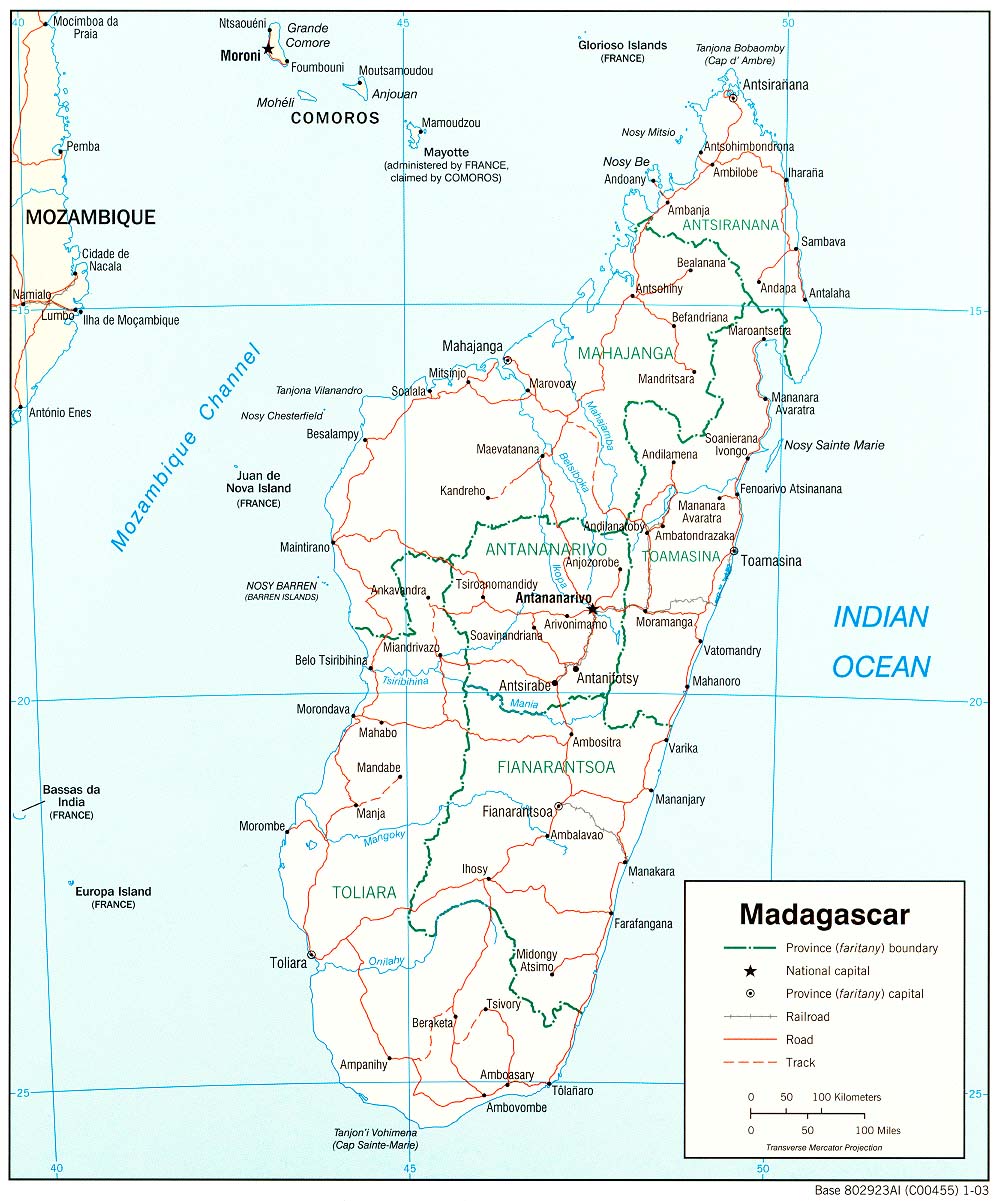 Madagascar is an island located between the Mozambique Channel and the Indian Ocean. It's capital is Antananarivo.
By the Way we just bought vanilla beans that were grown in Madagascar.
Thursday, December 20, 2007
Africa Challenge - Mozambique
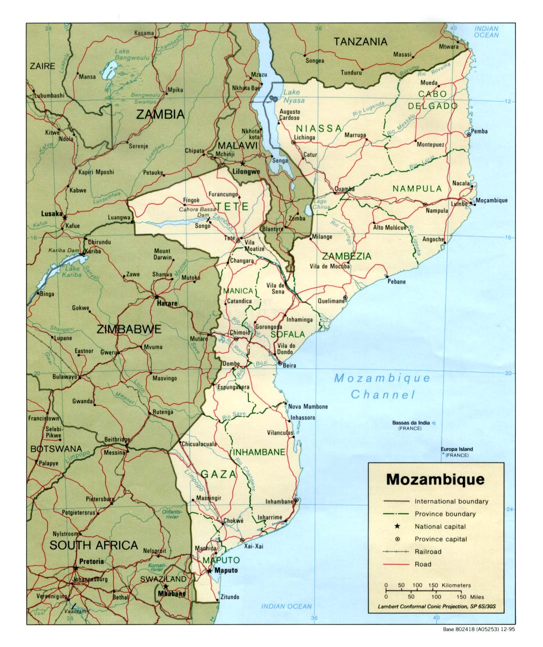 The next country to the south of Tanzania is Mozambique. Mozambique is across the Mozambique Channel from Madagascar and also borders the Indian Ocean, Swaziland, South Africa, Zimbabwe, Zambia and Malawi.
Wednesday, December 19, 2007
Russia

As we all know, Russia is the largest country in the world. However, it doesn't have that much history to tell. The first inhabitants of Russia were nomads and hordes of bandits and raiders. As you can think, they didn't bother to write down what they did. But as the population increased, these people developed a sort of wimpy form of government. The leader was a czar, and ever since those people have started, there hasn't been a nice one. The only one who actually did something instead of killing his own people was Peter the Great, who made the Russia we know today.
Physically Russia makes up half of the coast of the Arctic Ocean, borders the Pacific Ocean, Baltic, Black and Caspian Seas. Politically, Russia 13 countries altogether but only 9 in Europe. It shouldn't be that hard to find on an atlas.
Africa Challenge - Tanzania
 The next country to the south of Kenya is Tanzania which is right next to the Indian Ocean. Tanzania also borders Mozambique, Malawi, Zambia, Democratic Republic of the Congo, Burundi, Rwanda and Uganda. The Capital of Tanzania is Dar es Salaam.
Mount Kilimanjaro is also located in Tanzania.
Tuesday, December 18, 2007
Geography Challenge - Kenya
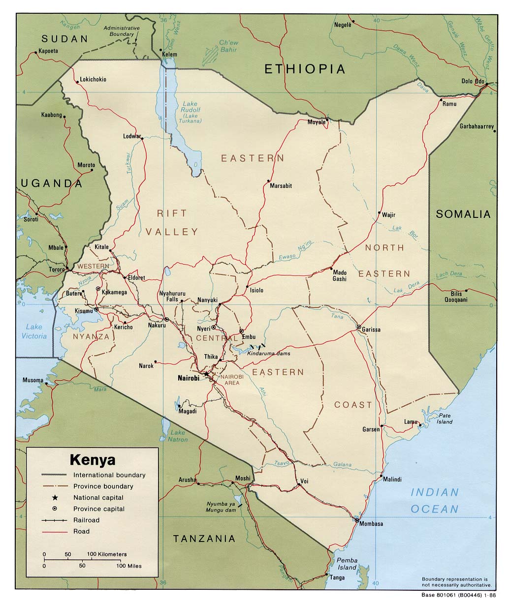 Just south of Ethiopia is Kenya which also borders Somalia, the Indian Ocean, Tanzania, Uganda and Sudan. Kenya's Capital is Nairobi.
Once upon a time our family figured out that you could have a Chocolate Cake Farm in southern Kenya.
Germany

Germany is a country of great importance in Europe. Along with its famous food, beer and car industry, Germany is also a country with lots of world history. The cathedral at Cologne and the ruins of the Berlin Wall are both monuments of important times in history. Germany is a great country.
Monday, December 17, 2007
Africa Challenge - Somalia
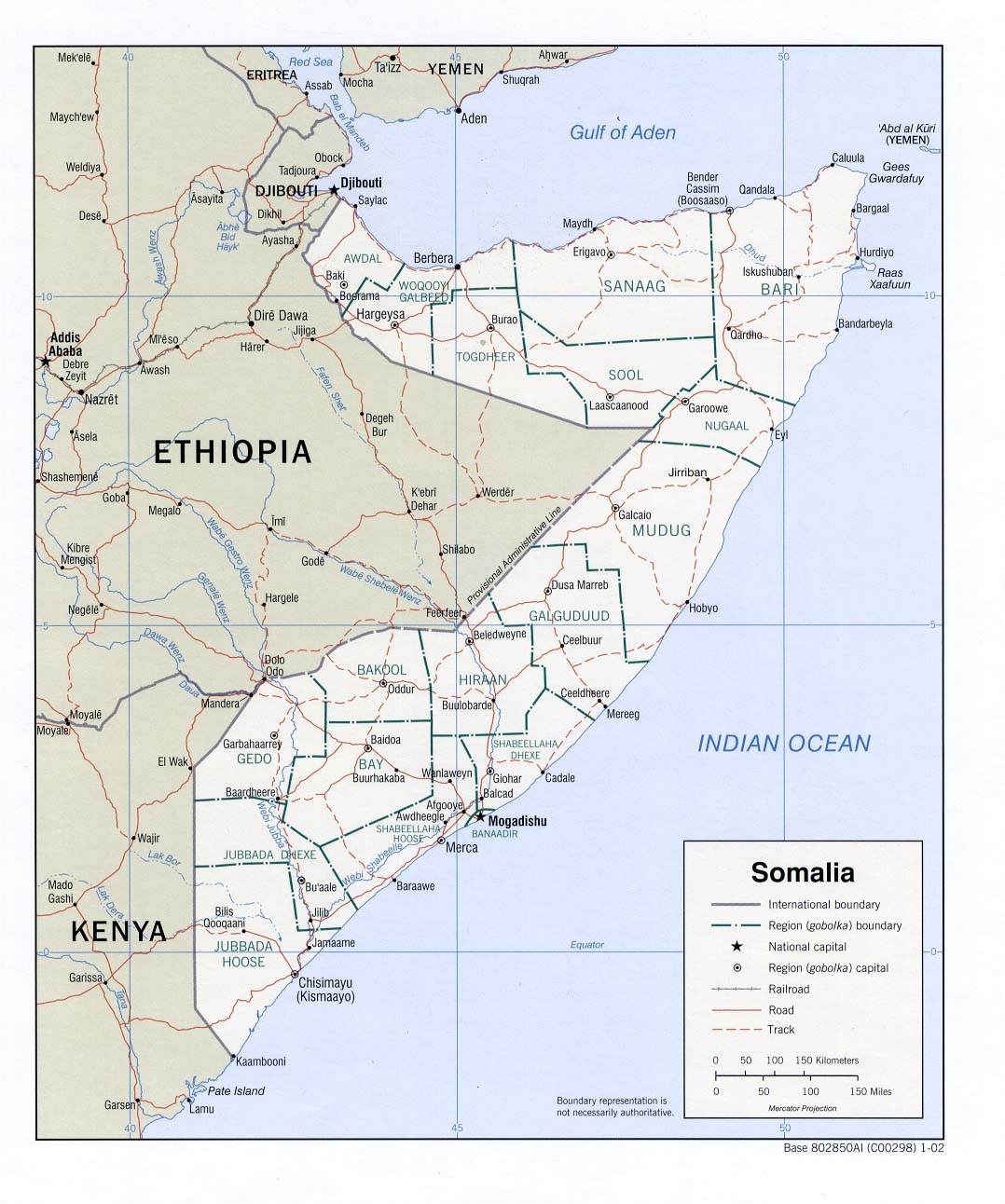
Somalia touches the Gulf of Aden, the Indian Ocean, Kenya, Ethiopia and Djibouti. The Capital of Somalia is Mogadishu (which is also really fun to say).
By the way Geospy is also a good way to practice the locations of countries in Africa. To get to the Africa challenge on Geospy you click "Countries Game" then click "Africa".
Sunday, December 16, 2007
Africa Challenge - Ethiopia
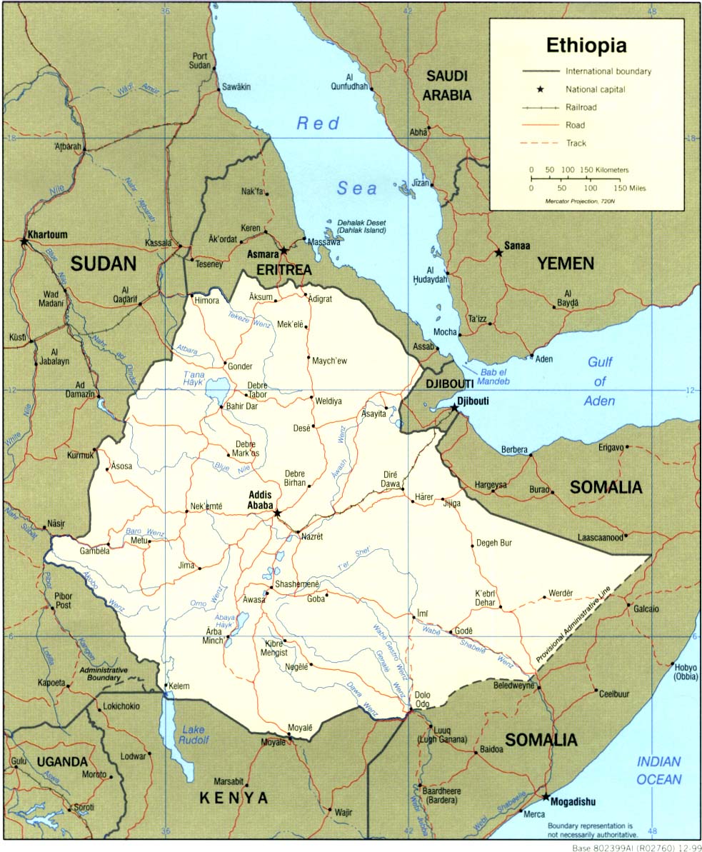 Ethiopia is located between Eritrea, Djibouti, Somalia, Kenya and Sudan. The capital of Ethiopia is Addis Ababa. Addis Ababa is one of the first African capitals I learned because it's so much fun to say.
 When I looked closer at the map of Ethiopia I was Surprised to find that it doesn't touch the Red Sea.
Saturday, December 15, 2007
Africa Challenge - Eritrea
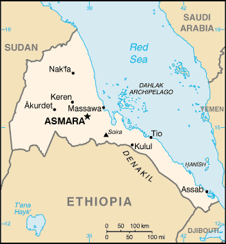 Eritrea is tucked between Sudan, Ethiopia and Djibouti and also borders the Red Sea. It's capital is Asmara
 Friday, December 14, 2007
Africa Challenge - Sudan
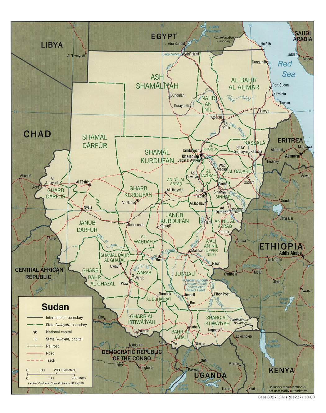
Sudan is the big country just south of Egypt. It is also bordered by the Red Sea, Eritrea, Ethiopia, Kenya, Uganda, Democratic Republic of the Congo, Central African Republic, Chad and Libya.
In Sudan the Blue Nile and the White Nile join together to form the Nile which flows northward into Egypt.
Important cities in Sudan:
Khartoum which is next to the Nile.
Port Sudan which is next to the Red Sea.
My mom says that the large region of Darfur in western Sudan is suffering from terrible violence and bloodshed. Please pray for them.
Neat Geography Game
Here is a really interesting Geography Game where you try to locate cities and famous places from around the world. This is one of the reasons I started the Africa challenge.
Thursday, December 13, 2007
OK, fine...I'll do Europe.

 Well, since he is going to do Africa, i thought I'd do Europe. To start off, I'll do England, the heart and soul of Europe. To narrow it down, Great Britain can go from mountainous to rolling hills, from one of the largest, and most ancient cities on Earth, to places where not one living thing is in sight.
London, the capital, is a city more than 7 and a half million people, and it's one of the largest trading centers of the world. Not only in business, but also in clothing fashions and music and lots of other things.
My oldest brother spent this past semester in London so I will be posting a few more things about it.
Africa Challenge - Egypt
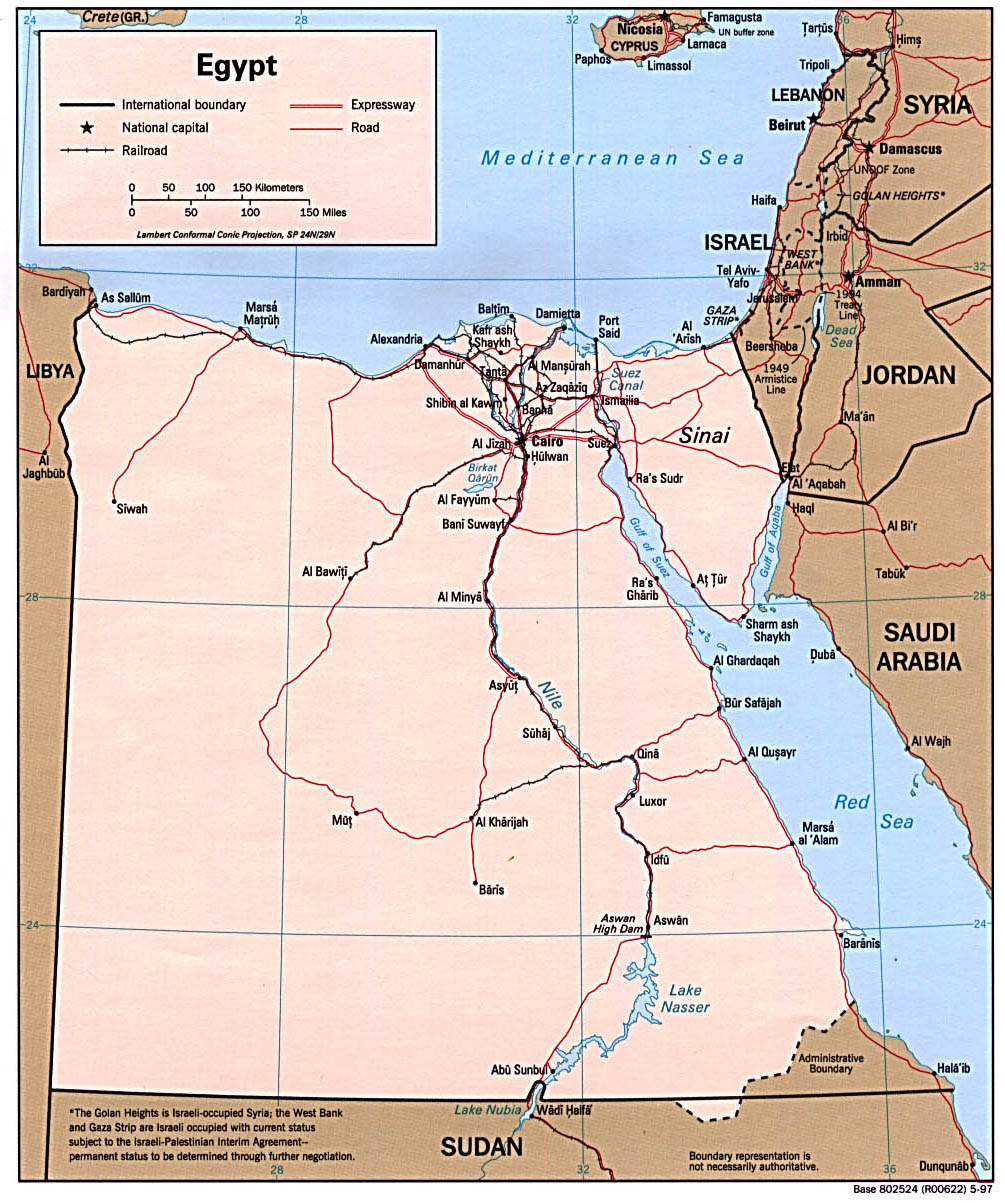 I challenge all my readers to learn the locations of different countries in Africa. Today we'll start with Egypt.
Egypt is located between the Red Sea, Israel (East), the Mediterranean Sea, Libya (West), and Sudan (South). The Nile (which runs from south to north) is a very noticable geographical feature. Near the mouth you'll find the major cities of Alexandria and Cairo as well as the Great Pyramids.
Let's take a quick tour of the Nile. Going from south to north there's ...
Abu Simbel (Abu Sunbul)
Aswan, site of a Famous Dam
Luxor (modern name of the ancient city of Thebes)
Giza (located just outside of Cairo)
Cairo
Alexandria - the city was founded by Alexander the Great and it is the site of the Lighthouse of Pharos (one of the Seven Wonders of the Ancient World).
Monday, December 03, 2007
The Holy Land (Israel)
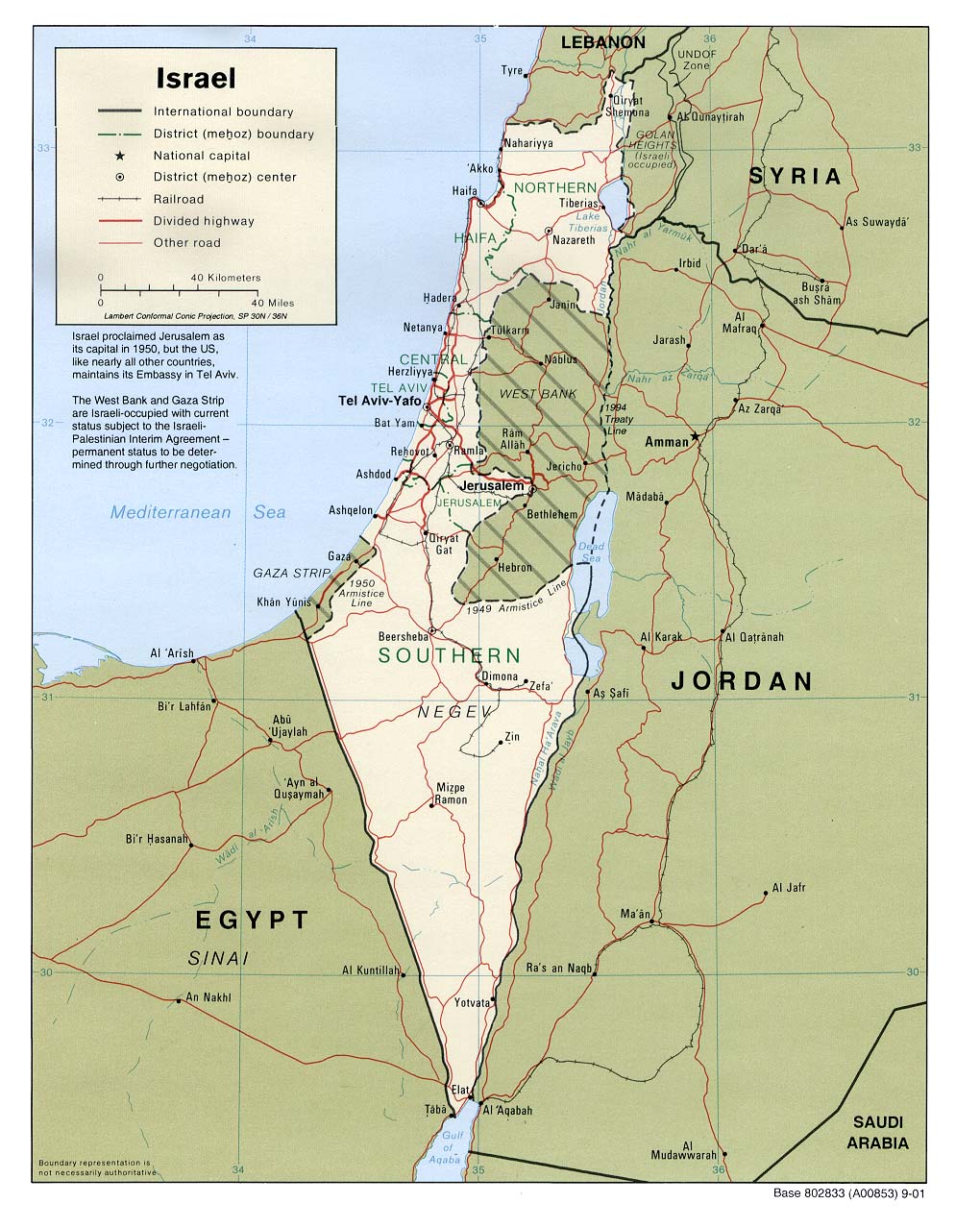
During Advent it's interesting to study the Holy Land because Jesus and the prophets lived there. Advent is when we remember how long the Israelites waited for Jesus to come.
We will start with the whole country of Israel. Here are some basic facts.
Area: 8,019 sq. mi.
Population: 6,135,000
Capital: Jerusalem
Religions: Jewish, Muslim, Christian, Druze
Languages: Hebrew, Arabic, English
Hear O Israel: The Lord our God is one Lord; and you shall love the Lord your God With all your heart, and with all your soul, and with all your might. And these words which I command you this day shall be upon your heart; and you shall teach them diligently to your children, and shall talk of them when you sit in your house, and when you walk by the way, and when you lie down, and when you rise. And you shall bind them as a sign upon your hand, and they shall be as frontlets between your eyes. And you shall write them on the doorposts of your house and on the gates.
Deuteronomy 6:4 - 9
Monday, October 15, 2007
Today is the feast day of Saint Teresa of Avila
 Here is picture from my grandparent's trip to spain of a statue in St. Teresa convent.
Sunday, September 09, 2007
Thursday, September 06, 2007
Spanish Map
 My Grandparents went on a trip to Avila, Spain this summer and here is a really neat map they saw there.
Monday, July 02, 2007
Monday, June 18, 2007

Friday, May 18, 2007

Wednesday, May 09, 2007
Geography Poem by Chesterton
Here is a poem by G.K. Chesterton about about Geography.
The earth is a place on which England is found,
And you find it however you twirl the globe round;
For the spots are all red and the rest is all grey,
And that is the meaning of Empire Day.
Click Here then scroll down to Geography to read the rest.
Monday, April 23, 2007
Easter Island


The Easter Island is located in the South Pacific and belongs to Chile. It has three volcanoes, Poike, Rano Kau and Terevaka.
It is most famous for its Moai, the stone statues now located along the coastlines. It gets its name of "Easter" because the first recorded European visit by a Dutch Admiral was Jacob Roggeveen on Easter Sunday, 1722. The population is 3,791.
Thursday, April 19, 2007
My Godfather Hosts Royalty
My Godfather is the co-director of INPE, National Institute for Space Research, in Brazil. Just yesterday, he gave Prince Andrew of England, 4th in line of the English throne, a tour of the INPE headquarters.
Sunday, March 25, 2007
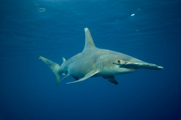
The Bahamas’ Sharks
 The Bahamas and its Sharks
The country of the Bahamas stretches for some 500 miles to the southeast of Florida. Millions of tourists flock to this remote country in the Atlantic Ocean, yet its real population is only about 311,000 people. Although many people think that it is in the Caribbean, it is not. As you would think, the Bahamas’ main source of income is tourism because of the relaxing beaches and warm, tropical weather.
The most fascinating thing that I find about that country is its diverse shark population. More than 40 species of sharks roam throughout the country’s warm waters. The kinds of shark that you would find there include the Tiger, Hammerhead, Lemon and Blue sharks.  For people to enjoy these magnificent creatures, the country of the Bahamas has established shark-seeing dives on numerous locations. This not only bolsters their economy, but it also gives people a good chance to look at sharks close up. If you went on one of these dives, you would find something new about sharks that would leave you dazed and open-mouthed for the rest of your visit.
This may sound like a haven for sharks, and it is. If I was a shark, and knew of that place, I would live there for the rest of my life. Even if I am not a shark, I probably would live there for the rest of my life anyway. Clear blue waters all around, peaceful and beautiful beaches, nearest factory at least 200 miles away; yeah, I think I can stay for a while longer.
Friday, March 09, 2007
Iditarod Dogsled Race


The Iditarod is a 1,150 mile dog sled race beginning in Anchorage, Alaska and ending in Nome, Alaska. A musher and his sled is pulled by a team of about 15 dogs. The race which began last weekend continues with many of them at what appears about half way. The race originated from the serum(medicine) run in 1925 when Nome had an outbreak of diphtheria and the only way to get the needed medicine was by dogsled. At that time it was a relay team of dog sleds. (Remember the story of Balto?) The Iditarod is raced every year with the southern route this year being an odd year. You can see the standings and a lot of other interesting facts(such as the location of each musher, the number of dogs he still has racing, video clips, the weather conditions, map including an elevation map) at www.iditarod.com One of the reasons that the Iditarod is interesting to me is that my Dad's high school friend, Jon Korta, is racing in it this year. He is bib #24. This morning his standing is 36 out of about 66 remaining racers. It seems he is doing well considering it's his first year. They are required to take one 24 hour rest period and it appears he is doing just that.
Friday, March 02, 2007
Invasion of Liechtenstein! (well not really)
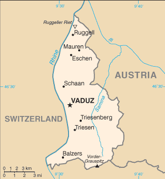
Did you know that it is possible to accidentally invade Liechtenstein? Switzerland does. I didn't know until today but now I do.
Friday, February 23, 2007
Mongolia: A Barren and Strange Country
 Mongolia: A Barren and Strange Country
Mongolia is literally a desert. The entire country is formed by the Gobi Desert, save a few mountains in the north. It is not near the sea so people cannot fish, and the land is unfertile so they cannot plant crops except in some places near the mountains.
So, instead of being farmers, most of the people of Mongolia are herders. They herd camels and they keep chickens. These people are constantly moving to find some good pastures. This makes Mongolia the least densely populated country in the world.
Mongolia is named after the Mongols, which was an army in the Ancient world that roamed across central Asia and Europe. At one point, the Mongols controlled an empire that stretched from Korea too Italy. No army has ever had so much land in its power ever since. The leader of this army was a man named Genghis Khan. When he died, his son Kublai Khan took over his kingdom.
Another interesting thing about Mongolia is that it is rich in dinosaur bones. Paleontologists from all over the world go there to find some new prehistoric creature. When the dinosaurs became extinct, the world was a little different. 65 million years ago Mongolia had a similar climate so the cold, dry environment preserved the bones very well.
Mongolia is a very primitive country. The people still live in yurts, which was the home of the Mongols, sort of like an Asian teepee. They are still nomads like their Mongol ancestors, but they are not warlike anymore. It is incredible how the lives of so many people can change so little through the centuries.
Friday, February 16, 2007
Malaysia
Malaysian Money
 Malaysians are experts in building techniques; hence the Petronas Towers in
Another main source in
Tuesday, February 06, 2007
Map of Rio

Hello again. This a cartoon map of Rio, and to my surprise, it was amazingly accurate. It shows the Sugarloaf Mountain, the rock by the bay, and the beach where I went to.
Tuesday, January 23, 2007
More on Brazil

Hello Again,
Here is a photo of me and my brother at a mountain called Maria Comprida (Long Mary). You see why it's called Long Mary because it slopes down, on the side that I was on, therefore earning its name.
Sunday, January 21, 2007
Geo Game

I did a previous post ot Christmas Ideas. This is what I got!!
It's a game called Geo Derby. You race around a track answering questions. There is a map if you need it:)
I think it is really Great!!!
http://http://www.boardgamesexpress.com/prodinfo.asp?number=8104
I am back from Rio de Janeiro!

Hey guys. I just got back from some of the best six weeks of my life.
Above is a map of the state of Rio de Janeiro. I was in the city of Petropolis, also known as the Imperial City. This particular area of Brazil is very mountainous and has very curvy. Almost everyone got carsick on the way there and on the way back. We did go to the beach once, and it was pretty cool.
I will report on my trip again.
Tuesday, January 09, 2007
Independence Quiz Answers
Here are the answers to the Independence Quiz.
- Oman - 1650 (from Portugal)
- India - 1947 (from the United Kingdom)
- Romania - 1878 (from Turkey)
- Mauritius - 1968 (from the United Kingdom)
- Vatican City - 1929 (from Italy)
- Sweden - 1523 (from the Kalmar Union)
- Liechtenstein - 1719 (from the Holy Roman Empire)
- Norway - 1905 (from sweden)
- Czech Republic - 1993 (from Czechoslovakia)
- Iceland - 1944 (from Denmark)
Friday, January 05, 2007
Independence Quiz
Here's how it goes I'll give you a list of 10 diferent countries and then the year they became independent in (with a dash inbetween). You guess (in the comment box) who they became independent from.
- Oman - 1650
- India - 1947
- Romania - 1878
- Mauritius - 1968
- Vatican City - 1929
- Sweden - 1523
- Liechtenstein - 1719
- Norway - 1905
- Czech Republic - 1993
- Iceland - 1944
Subscribe to:
Comments (Atom)
