1 year ago yesterday
Yesterday was this blogs 1st anniversary.
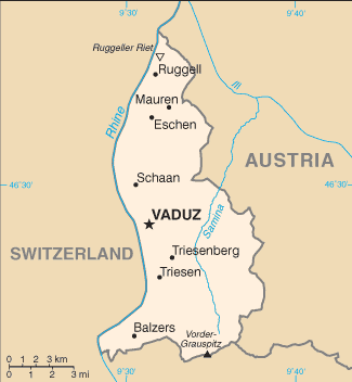
 My Grandparents went on a trip to Avila, Spain this summer and here is a really neat map they saw there.
Here is a poem by G.K. Chesterton about about Geography.
The earth is a place on which England is found,
And you find it however you twirl the globe round;
For the spots are all red and the rest is all grey,
And that is the meaning of Empire Day.
Click Here then scroll down to Geography to read the rest.


My Godfather is the co-director of INPE, National Institute for Space Research, in Brazil. Just yesterday, he gave Prince Andrew of England, 4th in line of the English throne, a tour of the INPE headquarters.
 The Bahamas and its Sharks
The country of the Bahamas stretches for some 500 miles to the southeast of Florida. Millions of tourists flock to this remote country in the Atlantic Ocean, yet its real population is only about 311,000 people. Although many people think that it is in the Caribbean, it is not. As you would think, the Bahamas’ main source of income is tourism because of the relaxing beaches and warm, tropical weather.
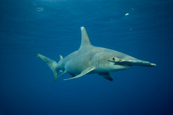
The most fascinating thing that I find about that country is its diverse shark population. More than 40 species of sharks roam throughout the country’s warm waters. The kinds of shark that you would find there include the Tiger, Hammerhead, Lemon and Blue sharks.  For people to enjoy these magnificent creatures, the country of the Bahamas has established shark-seeing dives on numerous locations. This not only bolsters their economy, but it also gives people a good chance to look at sharks close up. If you went on one of these dives, you would find something new about sharks that would leave you dazed and open-mouthed for the rest of your visit.
This may sound like a haven for sharks, and it is. If I was a shark, and knew of that place, I would live there for the rest of my life. Even if I am not a shark, I probably would live there for the rest of my life anyway. Clear blue waters all around, peaceful and beautiful beaches, nearest factory at least 200 miles away; yeah, I think I can stay for a while longer.


 Mongolia: A Barren and Strange Country
Mongolia is literally a desert. The entire country is formed by the Gobi Desert, save a few mountains in the north. It is not near the sea so people cannot fish, and the land is unfertile so they cannot plant crops except in some places near the mountains.
So, instead of being farmers, most of the people of Mongolia are herders. They herd camels and they keep chickens. These people are constantly moving to find some good pastures. This makes Mongolia the least densely populated country in the world.
Mongolia is named after the Mongols, which was an army in the Ancient world that roamed across central Asia and Europe. At one point, the Mongols controlled an empire that stretched from Korea too Italy. No army has ever had so much land in its power ever since. The leader of this army was a man named Genghis Khan. When he died, his son Kublai Khan took over his kingdom.
Another interesting thing about Mongolia is that it is rich in dinosaur bones. Paleontologists from all over the world go there to find some new prehistoric creature. When the dinosaurs became extinct, the world was a little different. 65 million years ago Mongolia had a similar climate so the cold, dry environment preserved the bones very well.
Mongolia is a very primitive country. The people still live in yurts, which was the home of the Mongols, sort of like an Asian teepee. They are still nomads like their Mongol ancestors, but they are not warlike anymore. It is incredible how the lives of so many people can change so little through the centuries.
Malaysian Money
 Malaysians are experts in building techniques; hence the Petronas Towers in
Another main source in

Hello again. This a cartoon map of Rio, and to my surprise, it was amazingly accurate. It shows the Sugarloaf Mountain, the rock by the bay, and the beach where I went to.

Hello Again,
Here is a photo of me and my brother at a mountain called Maria Comprida (Long Mary). You see why it's called Long Mary because it slopes down, on the side that I was on, therefore earning its name.

I think it is really Great!!!
http://http://www.boardgamesexpress.com/prodinfo.asp?number=8104

Hey guys. I just got back from some of the best six weeks of my life.
Above is a map of the state of Rio de Janeiro. I was in the city of Petropolis, also known as the Imperial City. This particular area of Brazil is very mountainous and has very curvy. Almost everyone got carsick on the way there and on the way back. We did go to the beach once, and it was pretty cool.
I will report on my trip again.
Here are the answers to the Independence Quiz.
Here's how it goes I'll give you a list of 10 diferent countries and then the year they became independent in (with a dash inbetween). You guess (in the comment box) who they became independent from.
There is a really neat animated map of diferent empires near the middle east. It shows 5,000 years in 90 seconds.
hat-tip: The Lilting House