Middle Eastern Empires
There is a really neat animated map of diferent empires near the middle east. It shows 5,000 years in 90 seconds.
hat-tip: The Lilting House
There is a really neat animated map of diferent empires near the middle east. It shows 5,000 years in 90 seconds.
hat-tip: The Lilting House
I just found out (again from The Handy Geography Answer Book) that 90% of all tornadoes occur in the United States.
These are a few gift ideas for geo freaks.
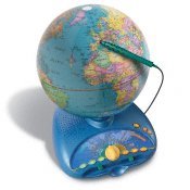
This is more of a family gift. It's expensive, but our family got one last year, and we use it all the time. Learn everything form the names of countries to the pronunciation of capital cities to other trivia. Two people can compete against one another in geography games. (My grandpa liked this one so much that he bought one of his own!)
Odyssey III Talking Globe ->
to view it click on the link below
http://www.leapfrog.com/Primary/GradeSchool/PRD_explorerglobe/Explorer+Globe.jsp?CID=KNC-CROSSQ4
World Discovery Deluxe Computer program -> 
This program helps you locate places throughout the world. It has different kinds of quizzes at three different ability levels, so again, the whole family can enjoy it.
to view click the link below
http://www.smartkidssoftware.com/ndgws2.htm
We have a lot of geography games in the house, but the ones below are ones we play the most:
Trans America and Trans Europe ->
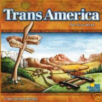
to view click the links below
http://www.fairplaygames.com/gamedisplay.asp?gameid=401&MP=1
http://www.fairplaygames.com/gamedisplay.asp?gameid=2826
Borderline card games ->
To view this and other versions click the link below
http://www.educationallearninggames.com/borderline-card-games.asp
(The links I've included should help you get more information on these items. I am in no way advertising for these sites, and haven't done any price comparisons or anything.)
* Please send some of you're favorite gift ideas so Mom knows what to get me!
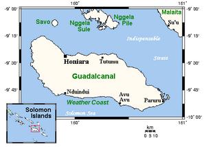 The Island of Guadalcanal: a place of beauty and violence
Even though just a small island in the Pacific ocean, Guadalcanal played a huge part in World War II. One of the bloodiest battles of all time was fought on the shores of this historic place. More than 2,000 American men were killed, while the Japanese buried ten times that amount. That many lives lost in only three days.
Even if it was a terrifying, not to mention deadly, area 60 years ago, Guadalcanal is now the most inhabited island in the Solomon Islands. With a normally tropical climate as well as beautiful beaches, it makes an excellent tourist destination. The country of the Solomon Islands lies about 200 miles off the coast of Papua New Guinea, another island country in the South Pacific.
Whereas 60 years ago there were ripped up planes falling from the sky every minute, ultra-intense combat everywhere, and the possibility that you might set off a land mine with any step you take, I think that one would rather enjoy being on the present-day island of Guadalcanal, one of the most lush and beautiful places in the world.
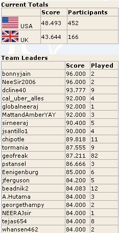 Here is the curent leaderboard on Geography Cup I'm at number 10 (I'm geofreak) and I played 82 times to get there.
Yesterday a new geography quiz site started called the Geography Cup . I think that U.K. and U.S. challenged each other. In it there are 13 questions the first ten are countries you have
to find then the last three are geography type questions
e.g. what country is the biggest producer of coacoa (which by the way is Cote D'ivory). Have fun.
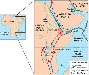 It's Coming Off
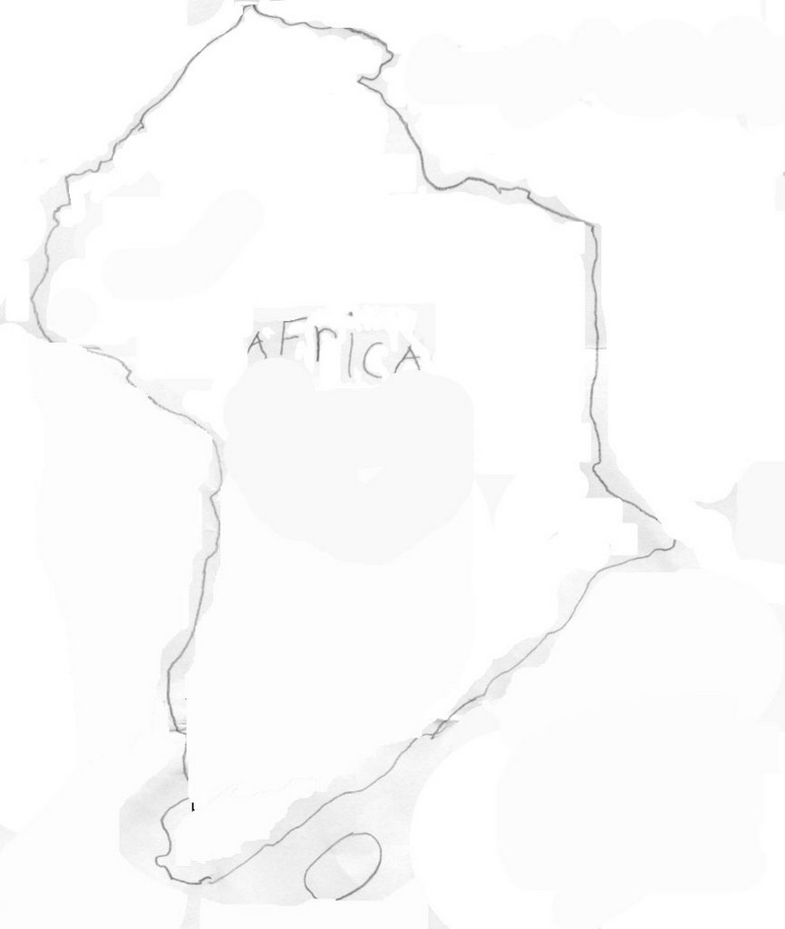
Encompassing many different countries in east Africa, and at a length of about 2000 miles, you have probably not heard of this spectacular land formation. I will not tell you the name, but I will give you clues in this paragraph, as I have given you two already. Ready… Go! Three lakes lie in it, Lake Victoria, Lake Tanganyika and Lake Malawi. One of the tallest mountains in the world lies on its' edge, Mt. Kilimanjaro. The worlds' longest river has its source in its area, the Nile River. Most of the Serengeti Plain lies within it. But perhaps the most important, concerning and amazing thing about it, is that it will cut the entire continent in two someday. Have you guessed it by now? If you have, good job, if you have not, it is the Great Rift Valley.
The valley does run through a great many countries, from Eritrea in the north, to Mozambique in the south, crossing ten other countries in between. The center of the valley covered with fertile plains, bordered by huge mountains and steep cliffs. I know that you have knowledge of the Serengeti Plain, and that most animals of Africa live there. Now as I said before, the Great Rift Valley will some day spilt Africa in half. The reason for that is because two of the Earth's plates are pulling apart from each other, or they're 'rifting,' creating a lowland or valley in between. At their current speed today, the plates should fully come apart in about 125 million years from now.
Diagram credits here.
1. Twenty-seven U.S. states have land north of Canada's southernmost point. True.
2. The 4,724-mi Trans-Canada Highway is the world's longest national highway. True.
3. Canada has fewer lakes than any other country in the Northern Hemisphere. False. With almost a million, Canada has more lakes than any other country in the world.
4. Canada's border with the U.S. is 5,525 mi long. True.
5. Since Toronto has no direct access to the Atlantic, all goods from the city must be shipped overland. False. The St. Lawrence Seaway connects the Great Lakes to the Atlantic.
6. Canada has the longest coastline of any country. True.
7. Canada covers three time zones. False. There are six time zones in Canada.
8. The climate in British Columbia is the most severe in Canada. False. British Columbia has the most moderate climate of Canada's regions.
9. Canada has mountains named for Santa's reindeer--Dasher, Dancer, Prancer, Vixen, Comet, Cupid, Donner, and Blitzen. True.
10. Few people in Canada live near the U.S. border. False. Most of Canada's population live within a few hundred miles of the border.
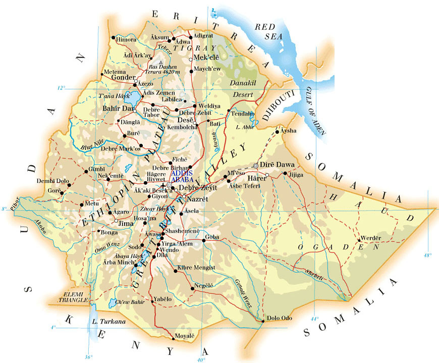 Last Saturday night, my family had some guests over for dinner. As you probably guessed from the title of this essay, their home country is Ethiopia. After they left, my mom told me that she had learned that since Ethiopia is such a mountainous country, their people are safe from most mosquito induced diseases, which are very common in that particular continent. A fact that I found to be very interesting is that eighty-percent of the mountains of Africa are located in Ethiopia.
I also think that it's very intriguing that Ethiopia is just barely landlocked by three countries; Eritrea, Djibouti, and Somalia. In the past, Ethiopia had a pretty funny name, Abyssinia. In World War II, Ethiopia was controlled by Italy, and the rest of Africa was controlled by the French, Spanish, British, German, and Portuguese. After the war however, the African modern nations started to form. One of these was Ethiopia, now a fully independent country.
Ria just recently posted about the Chocolate Cake Farm on Liber Parma.
First I looked in our encyclopedia for baking soda (which is one of the ingedients) instead I found baking powder which has baking soda in it and it had the scientific name in it to (sodium bicarbonate). Then I looked for sodium bicarbonate and I only found sodium but in that section there was part for other articles one of them was bicarbonate of soda. Then later electroblogster and I spent about an hour looking on the internet for where the ingredients would grow and came out with somewhere in southern Kenya, Africa.
 That One Country, Switzerland
There is one downside about this delicious treat. It is expensive. But if you go to any wedding or something like that, you will probably find that kind of chocolate, so eat all you can.
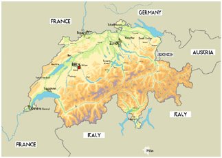
Chocolate is not the only thing that makes Switzerland such a special country. In Geneva, there are more banks within the metropolitan area of the city than any other city in the world. Switzerland is where many millionaires deposit their money to keep it safe because Swiss banks are high-security so they can not be robbed.
These are only a few things about Switzerland, out of at least a hundred more. Personally, I would greatly enjoy a trip to that one country, Switzerland
I was reading The Handy Geography Answers Book. In it I noticed that the average thickness of the ice in Antarctica is about a mile thick!
I was reading a book about the National Geographic Society's 100th Aniversary.
In it I found that the November 1910 issue was the very first issue to have colored photos.
It has three of those pictures. The first is a picture of some Japenese ladies. The second is some Chinese people riding on a horse-drawn cart. The third is a man from South Korea wearing a raincoat and hat made out of some sort of grasses. I thought it was interesting looking at the pictures and thinking that they weren't just pictures of people in costumes - these are pictures of people wearing their everyday clothes and doing ordinary things.
1. The driest place in the U.S. is Mount Waialeale on the Hawaiian island of Kauai. False (Thank you tito)
2. St. Augustine, Florida, is the oldest continuously inhabited city in the U.S. True
3. No U.S. cities have the same name as any state. False (New York- New York) Thank you Geoguy
4. The northernmost point of the lower 48 states is in Maine. False- it is Minnesota
5. A pipeline brings oil 800 mi (1,280 km) from oil fields in northern Alaska to the port of Valdez. True
6. A state park in Georgia consists of half a million acres of swamp (2,000 sq km), the Okefenokee Swamp Park. True
7. The letters Q, X and Z do not appear in the name of any U.S. state. False- (Arizona-Texas)
8. The northernmost U.S. state capital is Juneau, Alaska. True
9. The only active diamond mine in the U.S. is in Arkansas. True
10. With an area of just 1,214 sq mi (1,953.7 sq km) Rhode Island is not only just the smallest state; it is also smaller than any country in Europe. False (Luxembourg)
Thanks for the help everyone